| 2002 Xenia Half Marathon and ORRRC Marathon |
|
HOME
Dial 937-640-2RUN. You are visitor |
Course Layout
Course
The new (for 2001) course tours the Historic District of Xenia, as well as several residential neighborhoods, the County Fairgrounds, and three of the four separate bikepaths that are offered by the Greene County Parks and the Little Miami State Park.
The start is located on Church St. behind the Holiday Inn. Follow Church St. east and turn left onto N. King St. Turn left onto Fairground Rd (Ankeny Rd), turn right onto Purcell Dr., turn right onto Hollywood Blvd. and cross Route 68.
Turn right onto the bikepath (in front of McDonalds) and head south towards downtown. Exit the bikepath to the left at Weaver St. and make an immediate right onto Detroit Blvd. Detroit Blvd. travels parallel to Route 68 and passes in front of the pond at Shawnee Park. Turn left onto S. Park Dr., turn left onto Edison Blvd., which bends to the right at Sutton and follows the perimeter of the school grounds.
Next, turn right onto Monroe St., right onto Garfield and left onto Collier St. Turn left onto Main St. (Route 35 East) and then bare right onto Jasper Rd. Make a right onto the bikepath and follow it to the end. Upon exiting the bikepath, please be careful while stepping down a high curb and turn right onto Hill St. Turn left onto Detroit St. (Route 68) and make a right onto Miami St. Follow Miami St. to the end where it intersects Cincinnati Ave. (Route 42). Cross Cincinnati Ave. and enter the bikepath.
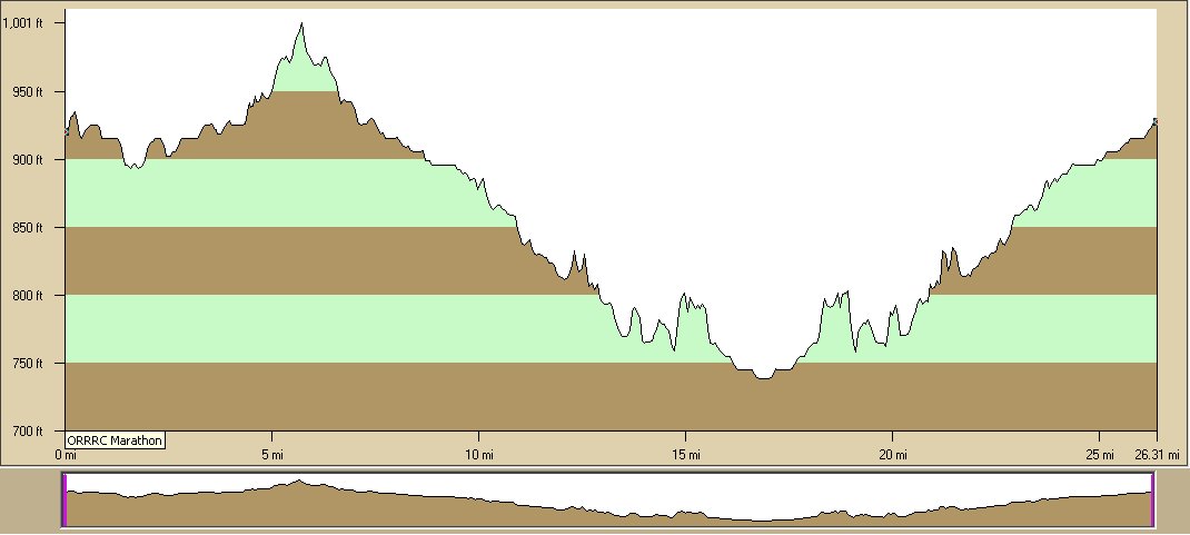
Follow it to the turnaround points and back to the finish line. The Half Marathon turnaround point is located approximately 0.1 miles north of Hedges Rd. (approx. 10.2 miles into the race). The marathon turnaround is located approximately 1.25 miles south of Roxanna-New Burlington Rd. (approx. 16.75 miles into the race). The finish line is located on the bikepath approximately 0.2 miles west of Xenia Station, just prior to crossing Miami Ave. at the intersection of S. West St.